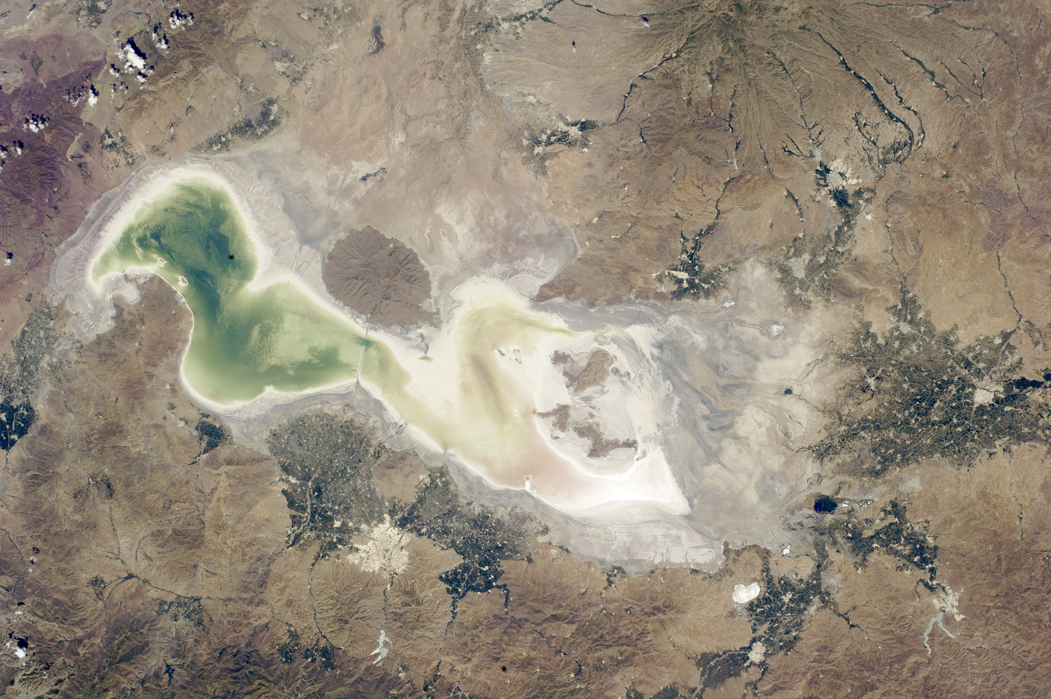
Green and tan shades show the extent of the water in Lake Urmia (also Orumiyeh or Orumieh) in western Iran. The lake is highly saline and only a few tens of meters deep even at high water. The shoreline appears as a white margin of salt. The lake is one of the largest in the Middle East, measuring 130 kilometers (80 miles) from the northern shoreline to the vegetated delta.
Rivers that flow into the lake appear as narrow green lines, especially on the southeastern lake margin (image top right). These rivers form deltas marked by clusters of green agricultural fields; soft soils and the nearby water supply support farming in an otherwise dry region. The lake and its wetlands have been declared a UNESCO Biosphere Reserve.
The city of Urmia stands out as a distinct gray patch surrounded by fields. On the opposite shore, an extinct volcano appears as an oval shape. A causeway and bridge connect the shorelines at this point.
The lake has been experiencing a drastic loss of water and now holds only 5 percent of its known high-stage volume. The drying is vividly illustrated by the fact that the volcano used to be entirely surrounded by the lake. The drop in water levels is related to a long-term decrease in rainfall and the extraction of water for farming. The progressive drying of the lake since 1984 is shown in this sequence of still images.